

Small pull-out for the Waterfall Creek Trail.
Initially the trail ascends using an old mining road.
Entering the valley housing Waterfall Creek. The ridge housing Yellow Mountain seen above.
Past an easy-to-miss trail junction, continuing along the Waterfall Creek Trail as it ascends via singletrack.
View back down the Waterfall Creek basin.
Traversing above the basin. A massive cascade seen ahead.
The trail ascends toward the cascade, passing above steeper terrain.
Beneath some cliffs and up to the drainage above.
Incredible morning view as we ascend a flatter section of trail through gorgeous meadows in the upper basin. Ulysses S. Grant Peak seen above.
Close-up toward the waterfall at the head of Waterfall Creek, seen center. The trail leads to the left of its outcropping.
Waterfall Creek Trail becomes thinner, and eventually becomes too hard to follow.
We managed to find the trail again higher up as we ascend past the waterfall pictured earlier. It switchbacks up the slope to gain the top of the falls.
View back down into the gorgeous meadow-filled drainage as we ascend above the waterfall.
Just above the waterfall, Pilot Knob came into view (center).
View back, colorful water draining into the waterfall.
We ascended via the watercourse to avoid the lumpy terrain on either side.
A shot back, V3 seen above.
Matt looking up at Pilot Knob.
We entered a wide basin and ascended the grassy slope (center) on the west side of Pilot Knob (top left out or frame).
View back into the basin as we near the north ridge of Pilot Knob.
Side-hilling over to the ridgeline. Pilot Knob seen center.
A social trail led tightly up the scree slope.
View back down the ridgeline. The Wilson group seen top left.
Approaching the base of Pilot Knob.
Just below Pilot Knob's sheer north face, view back down the ridgeline.
Loose, horrible terrain traverses just beneath the western base of Pilot Knob.
I recommend getting as high as possible when you can, hugging the base.
View back along the base.
Just before reaching the southern end of Pilot Knob, a steep Class 3 chute leads up a weakness to the crest at the top of the knob.
View back down the weakness.
Some slightly tricky route-finding. You can easily turn this into true Class 4 if not poking around properly for the easiest route.
Now along the ridge crest, a few blobby obstacles force small ups and downs.
Despite how narrow the ridge was, it only felt particularly exposed a couple of times.
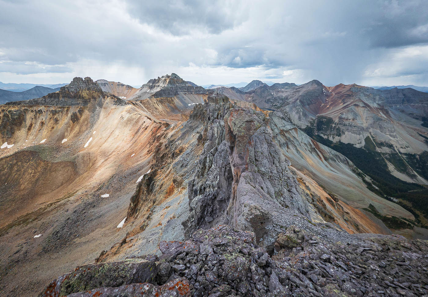
View back along the Pilot Knob crest.
A Class 3/4 boulder obstacle. Past this, Chris is seen on a sloped ledge that ventures into Class 4 territory. Then there's just a final scramble to the summit.
Just below the summit, looking back at the narrow portion mentioned above.
Pilot Knob summit, view northeast toward Ulysses S. Grant Peak.
Pilot Knob summit, view east into Ice Lakes Basin.
Pilot Knob summit, view south toward Vermillion Peak, Golden Horn, etc. San Miguel Peak seen on the right.
Hire me or show me some love!
Hire/refer me as a web developer or send me a few bucks if you find my site useful. I’m not sponsored, so all fees are out-of-pocket and my time preparing trip reports is unpaid. I really appreciate it!