

Starting from the Ebbetts Pass Trailhead.
First view of the beautiful volcanic ridgeline that I would hug for much of the day. I'll be coming down from up there at the end of my loop.
The hike is a forested walk along the PCT for the first few miles.
Some occasional nice views over toward Highland Peak (far left).
View back along the PCT, Silver Peak poking out top right.
The volcanic ridgeline appeared on the right, cool pinnacles crowding the slope.
Past the junction with the Noble Canyon Trail, the PCT begins to climb. This is a view back, the volcanic ridgeline housing Tryon Peak seen above.
The PCT hugs volcanic formations for a while.
A faint social trail leaves the PCT just before Noble Lake, and begins east.
Along the faint social trail, looking back toward Noble Lake. Tryon Peak up there on the left, which I'll be reaching later on.
A view toward Raymond and Reynolds to the northwest.
The route-finding wasn't too hard, and some cairns helped mark the way, but I generally just stuck to the base of the slope, just at the point where it gets steeper.
View back as I found a more obvious social trail leading to a minor saddle on the south ridge of Highland Peak.
Starting up to Highland Peak once on its south ridge.
View back at my progress along the steep slope. Noble Lake seen on the right, beneath Tryon Peak.
It's a little bit sloggy up Highland Peak, and the social trails are braided and not intuitive to follow. They often lead away from the crest for no apparent reason.
Another shot back, Highland Lakes now visible top left near Folger Peak.
Loose, ashy-looking terrain.
View back after passing a noteworthy pinnacle.
False summit of Highland Peak ahead. It's not actually as brushy as it looks, but there was some tree-dodging as I made my way up the steep, sandy slope.
Nearing the false summit, view back at the sandy ascent section.
Close-up toward Tryon Peak (top right) and Noble Lake (right). Highland Lakes top left.
Onward to the true summit, far right.
The descent ridgeline from the false summit got a little rocky, Class 2. The crest is trickier, but routes exist on either side of it.
View back up toward the Class 2 drop from the false summit.
Highland Peak ahead, a bit of brush near the saddle.
Nearing the summit of Highland Peak, view back along the ridgeline to the false summit.
Class 2 to the summit. Class 3 if going directly, but you can wrap just to the right of the summit block for an easier option.
Highland Peak summit, view north toward Silver Peak.
Highland Peak summit, view southwest.
Past Noble Lake, heading along the PCT to a saddle on the east side of Tryon Peak.
View back along the PCT. Raymond/Reynolds seen in the distance.
Tryon Peak visible above.
From the saddle, I left the PCT and headed up to Tryon Peak.
Class 2, and a tad brushy.
View back, Highland Peak top center, Noble Lake below it.
Approaching the short section of Class 2 to gain Tryon Peak.
Tryon Peak summit, view toward Highland Lakes.
Onward to the north along the volcanic ridgeline.
Tundra and cool boulders strewn about. Definitely no social trails to be found here. I was hoping for a weakness in the cliff ahead to get up to Peak 9731.
And I found one, via this loose Class 2 gully.
View back toward Tryon Peak (right).
Awesome volcanic cliffs along the rim. The PCT is below somewhere, where I'd hiked in on.
Peak 9731 summit, view south toward Tryon Peak and some cool volcanic cliffs.
Peak 9731 summit, view north.
Ugh, a surprise crap terrain section. It was short-lived, but I thought I was home-free. I stayed high as long as I could, and surprisingly the crest kept Class 2/2+ for many sections. Dropping down to the left avoids the majority of the mess, but I had some fun wandering around the eroded hoodoos.
View back during my exploration of the pinnacles along the crest.
Another shot back at where it's clearly much easier to just drop away from the crest to avoid the obstacles.
Kinney Reservoir seen below as I continue north along the rim.
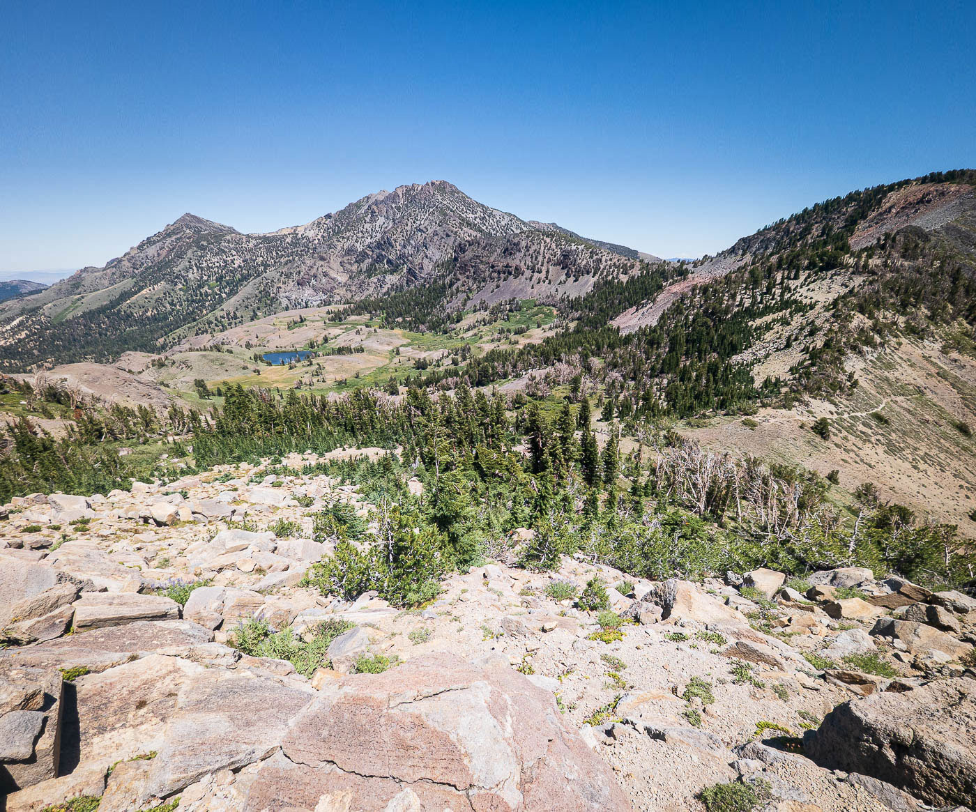
Highland Peak (left), seen from the volcanic rim.
I chose a less direct route off the rim to regain the PCT since going directly north was really loose and steep, and my slope choice was much better.
Hire me or show me some love!
Hire/refer me as a web developer or send me a few bucks if you find my site useful. I’m not sponsored, so all fees are out-of-pocket and my time preparing trip reports is unpaid. I really appreciate it!