

The Lake Charles Trail veers away from the doubletrack shortly after starting from the trailhead.
The Lake Charles Trail is lush.
Little meadows and swamps pop in once in a while.
And sometimes it lingers next to the sounds of East Brush Creek.
View south through the trees along the Lake Charles Trail.
Some steeper ascending as I made progress up to Lake Charles.
Fools Peak seen on the horizon. A bit before reaching Lake Charles, I left the Lake Charles Trail in order to ascend northeast through a drainage with some flowing water.
A social trail led up this drainage for some time, but it was difficult to follow. Mostly, cairns just aided in avoiding little cliffs along the watercourse.
I was able to avoid most of the brush, but sometimes I made mistakes and ended up talus-hopping or bushwhacking for a few feet.
Looking back as I continue up the drainage off-trail.
The drainage was pretty and very green, and while I had no trouble following its trajectory, I'm sure there are more efficient micro-routefinding choices I could have made.
I emerged above treeline and into the talus slope below Gold Dust Peak (left) and Pika Peak (right). I left the drainage and ascended the grassy slope on the left here, heading north.
Tundra hiking for a bit to the base of Gold Dust Peak, seen ahead.
A view toward the traverse I'll be on later between the two peaks. Note the two rock spires seen at the saddle: wrapping around those would be the Class 3 crux of the day.
View back at my progress up the tundra.
Class 2 scramble to gain Gold Dust Peak's southwest slope. It was steep, but not troublesome.
A view back down the steep ascent. Fools Peak seen top left. I came up from the center of this photo.
I soon reached the southwest slope, view back down. Pika Peak top left.
Close-up at the Class 2 slope.
Class 2 up to the summit. Short sections of grassier terrain broke up the predominantly talus schlep.
Nearing Gold Dust Peak, view back at the Class 2.
Gold Dust Peak, view north toward New York Lake. Finnegan Peak seen right.
Close-up into the valley housing New York Lake.
Onward for the traverse to Pika Peak. Seen here I'm looking back toward Gold Dust Peak along a surprise near-knife edge scramble with a couple of Class 3 moves.
The ridge curved south and began descending from Gold Dust Peak. Big Spruce Lake seen on the left, Pika Peak far right. Mount of the Holy Cross top left.
View back up toward Gold Dust Peak as I kept along the ridgeline, or just beneath it.
A steep, loose Class 2 section.
Looking back at some broken terrain along the crest.
Nothing exceeded Class 2 until reaching the saddle below.
Some more loose Class 2 to reach a pair of rock spires at the saddle. I wrapped to the left (east) around the first, which is seen center.
After wrapping around the first, a chute led up to a Class 3 series of moves seen above.
View back down the Class 3 moves, Big Spruce Lake seen below.
I then wrapped to the right (west) around the second rock spire, Class 2+.
Now past the second spire, a bit more Class 2/3 terrain (depending on your route choice) leads up. The initial 50 feet was loose and dangerous, but I found the subsequent part to be pretty fun.
View back toward the second and first spires, Gold Dust Peak top left.
Close-up back down at the loose ascent.
I kept to the right of the crest from here because it looked far too steep, using a must more reasonable Class 2/2+ chunky and broken face to gain the summit.
An ascending traverse up this fun, blocky route to Pika Peak's summit.
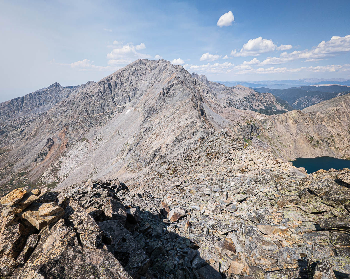
Nearing the summit of Pika Peak, view back along the traverse to Gold Dust Peak.
Pika Peak just ahead.
Pika Peak summit, view southeast. Mount of the Holy Cross seen left of center, Mount Jackson far left.
I descended west from Pika Peak on terrain very similar to the approach for Gold Dust Peak. Fools Peak seen left.
Class 2 talus-hopping for a while. Lake Charles, my next landmark, seen below.
There were a couple of little cliffs to avoid on my way down, but overall it was a straightforward descent choice. Fools Peak seen right.
Looking back, I found what seemed to be a wide, key gully yo get past the little cliffs, seen here.
I then dipped back under treeline and found my way back to the Lake Charles Trail. I managed to avoid pretty much all bushwhacking.
Along the Lake Charles Trail once again.
Lake Charles, view up toward Fools Peak.
Hire me or show me some love!
Hire/refer me as a web developer or send me a few bucks if you find my site useful. I’m not sponsored, so all fees are out-of-pocket and my time preparing trip reports is unpaid. I really appreciate it!