Class 1 4.1 miles 2000 gain 2-4 hrs Out + Back Jun 16, 2025
Effort
Beauty
Personality
Solitude

Dry Mountain GPX Track

I need to offset my substantial website costs somehow! You can download a hike/drive GPX to assist you here. Before sharing my GPX tracks with others, please remember my site is otherwise a free resource.

Dry Mountain is located just east of Mount Nebo, a high prominence summit in the Wasatch Range. It receives relatively few visitors compared to its famous ultra-prominent neighbor. You can approach from the east via Santaquin Canyon Road (014) or from the Mount Nebo Loop Road. Both routes are passable for passenger cars, but once you turn northwest here (39.91747, -111.71904) toward the trailhead, the road becomes deeply rutted and requires higher clearance.

The hike begins along the Sheepherder Trail for a short distance before reaching a saddle. From here, I headed west along an excellent social trail that made a few broad switchbacks up the slope and eventually brought me to the south ridge of Dry Mountain. In a couple of places the trail was faint, and higher up it became somewhat overgrown, but it never caused much trouble.

The ridgeline ascent to Dry Mountain was steep for about 800 vertical feet, with a social trail climbing almost directly along the crest. Continuing north along the more tame grade, the trail faded away, but the crest was easy to follow as it undulated a few times before reaching the summit. I’d feel weird call this hike Class 2 since it’s a trail the whole way, but the summit ridge gets a little bit more rocky. The views toward Mount Nebo, Loafer Mountain, Utah Lake, and beyond were excellent.

PEAKS ON HIKE
Elevation (ft) / Prominence (ft)
Peaks on hike
Elevation
Prominence
1
Dry Mountain
9860 ft
1829 rise

Hire me or show me some love!

Hire/refer me as a web developer or send me a few bucks if you find my site useful. I'm not sponsored, so all fees are out-of-pocket and my time preparing trip reports is unpaid. I really appreciate it!

Sheepherder Trailhead.
At the saddle, where I left the Sheepherder Trail and followed the social trail head. Dry Mountain's ridgeline seen above.
Along the social trail as it leads through a meadow and then into the forest.
Final switchback to gain the ridgeline.
View back down the slope, the Sheepherder Trailhead somewhere on the right.
Steep ascent north along Dry Mountain's ridgeline.
A social trail leads up.
View back down to the saddle. I considered hiking to the unnamed peak in the center, but it looked like a tedious burn area.
The terrain becomes more tame along the crest.
Some slight undulations as I make my way to Dry Mountain, seen ahead.
It was a lovely stroll along the ridge crest.
Nearing the summit of Dry Mountain.
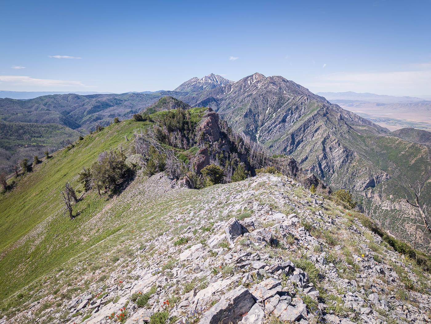
View back along the ridgeline.
Close-up toward Mount Nebo.
View north. Utah Lake on the left.
Loafer Mountain to the north.
View northwest toward civilization and Utah Lake.
Another shot south toward Mount Nebo from the summit of Dry Mountain.

Hire me or show me some love!

Hire/refer me as a web developer or send me a few bucks if you find my site useful. I’m not sponsored, so all fees are out-of-pocket and my time preparing trip reports is unpaid. I really appreciate it!