Snowy Mountain

Adirondack Park, NY Adirondack Mountains

Trip stats

Distance
7.6 mi
Net Gain
2,200 ft
Time
3-5 hrs
YDS Rating
Class 2
Route
Out/Back
Peaks
1

Ratings out of 10

Effort
3.8/10
Personality
4/10
Beauty
4/10
Solitude
2.9/10
What do these mean? →

Peaks on this hike

Summits listed in route order

  1. Snowy Mountain
    3,900′ elevation · 2,255′ prominence

Route map + Trailhead

Trailhead Coordinates

43.701280, -74.334820

The directions link below drops a pin on the trailhead coordinates and lets Google Maps pick the route. If the drive has rough roads or access issues that GPS nav might get wrong, I cover that in my trip report.

Trip report

Jul 6, 2025 — Snowy Mountain is a prominent peak that rises alone, set apart from the higher cluster of Adirondack summits. Its summit is crowned by a restored fire tower.

Parking is located across a busy highway, and the hike begins at a gradual pace through the forest. The trail crosses a few creeks, sometimes aided by small constructed bridges. After a couple of miles, the trail steepens. What starts as a gentle dirt path gives way to typical Adirondack rugged ledges and slippery rock. A short Class 2 move leads to the top of the steep section, followed by a more moderate grade where braided social trails make the official path tricky to follow.

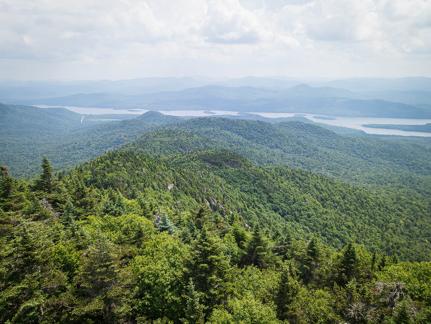
Soon after, I reached the fire tower and climbed up into its cabin. Without it, there would be no views of the surrounding peaks and Indian Lake below.

Hire me or show some love!

Hire or refer me as a web developer, or send me a few bucks if you find my site useful. I'm not sponsored, so it's funded by yours truly. It also takes a ton of work to edit photos and write these reports. I really appreciate it!

Photos

13 photos

  1. Snowy Mountain trailhead, located across the highway.
  2. Gradual forest walk for the first few miles.
  3. Crossing over a creek.
  4. Boardwalks avoiding bogs.
  5. Well-maintained and heavily traveled trail for the more gradual sections.
  6. Starting to ascend more steeply out of the lower elevations and away from Beaver Brook.
  7. More roots and a more difficult grade.
  8. And then a few hundred feet of ascending typical slick Adirondack rock ledges and boulders.
  9. View back down the trail, which degrades a bit from erosion higher up.
  10. A short scramble to escape from the rocky, steep slope ascent.
  11. A short walk on more tame terrain leads to the fire tower.
  12. Snowy Mountain Fire Tower.
  13. Snowy Mountain summit, view east toward Indian Lake.

Photo 1 of 1

Hire me or show some love!

Hire or refer me as a web developer, or send me a few bucks if you find my site useful. I'm not sponsored, so it's funded by yours truly. It also takes a ton of work to edit photos and write these reports. I really appreciate it!

GPX track

Snowy Mountain GPX route and driving track

The complete GPX track is available to download, so you can load the route straight into your navigation app or device. The trip report, route info, photos and planning details stay free.