Mount Redfield, Cliff Mountain, Mount Marshall in Adirondack Park, NY

Hike Mount Redfield, Cliff Mountain, Mount Marshall Adirondack Park, NY

Class 3 23.1 miles 6300 gain 10-14 hrs Loop Jul 4, 2025
Effort
Beauty
Personality
Solitude

Mount Redfield, Cliff Mountain, Mount Marshall GPX Track

I need to offset my substantial website costs somehow! You can download a hike/drive GPX to assist you here. Before sharing my GPX tracks with others, please remember my site is otherwise a free resource.

Jul 4, 2025 — Mount Redfield, Cliff Mountain, and Mount Marshall aren’t often tackled together, but I wanted an efficient way to knock all three Adirondack 46ers off in one go. A few days earlier, I’d planned to pair Redfield and Cliff with Skylight and Gray, but when that plan fell through, this became the backup. Normally, people approach Redfield and Cliff from the Upper Works trailhead, but since I’d just come from that direction, I decided to mix it up and start from the Adirondack Loj instead. While these three particular 46ers don’t really have expansive views or overly memorable scrambles, this ended up being a nice day out with plenty of water-carved features and greenery.

Being July 4th, I half-expected the trail to look like a parade route, and while it wasn’t too bad, I still managed to miss out on snagging a coveted parking spot at the Loj because I’m physically incapable of waking up and starting hikes early. So I got the bonus mileage of having to park farther away, the silver lining being that I didn’t have to pay the steep parking fee. Note: my stats reflect starting at the Loj.

From the Van Hoevenberg Trailhead, I eased into the day on a pleasant path dotted with little boardwalks and bridges through the forest. Nothing too exciting happened until Marcy Dam, where Mount Colden dominated the southern view like it owned the place. I turned south along the Avalanche Pass Trail, paralleling Marcy Brook, occasionally hopping across boardwalks in muddy spots.

Avalanche Pass itself was a treat. The trail squeezes between moss-covered rock walls, a beautiful gateway to Avalanche Lake. Only a week later, a massive landslide would rip down Mount Colden and close the pass; part of me wishes I could have seen the fresh scar. The trail hugged the lake’s north shore on impressively engineered boardwalks and stairs over the water. Past the lake, I wrapped around the south side of Lake Colden, with Algonquin Peak looming to the north and Mount Marshall staring me down, reminding me it was on my itinerary for later today.

Continuing east along the Mount Marcy Trail, I crossed a suspension bridge over the Opalescent River and hiked above a narrow, rushing chasm, a highlights of this section deep in the High Peaks. At the junction for Redfield and Cliff, I veered left for Mount Redfield first, following Uphill Brook through lush forest on a narrower route, clearly less maintained than the trails I’d been on so far today. The trail quickly turned into a boulder scramble, getting steeper until I reached the summit.

Back at the junction, I aimed for Cliff Mountain. It started innocently enough, though a bit boggy, but soon introduced steep scrambles, Class 2+ and 3 moves, with an extended slab section that was surprisingly fun. After a false summit, I hit the real Cliff Mountain and checked off number two for the day.

Last on the list for the day was Mount Marshall. The plan was to summit, then descend north via the Indian Pass Trail to create a partial loop since I’d never hiked in the High Peaks north of Mount Marshall. I briefly considered ascending via the Cold Brook Trail to check out a historic airplane crash site, but instead chose the Herbert Brook Trail after learning it was reportedly more well-traveled.

I backtracked for a bit and then crossed the boardwalk on Lake Colden’s south side and found the easy-to-miss Herbert Brook Trail shortly after. This trail was gorgeous: lush, green, and often following slickrock right up the brook, with cascades spilling all around. It stayed easy to follow, though it narrowed at times, and eventually climbed steeply toward the summit. Eventually, it steepened toward the viewless summit.

I had to hunt a bit to find the unmarked Mount Marshall Trail for my descent, which quickly became clear it wasn’t a popular route. The drop to the saddle with Iroquois Peak was steep and rough. I then turned north on the Cold Brook Trail, which was overgrown and faint in places, sometimes just a rock-hop along the drainage itself. I thought it was kind of a nice addition to the day since most other trails are heavily traveled, whereas back here I got ample solitude, albeit definitely a few branches in my face. A pretty waterfall was the last notable stop before I joined the Indian Pass Trail.

I reached the Indian Pass Trail, where blowdowns and poor markings added a bit of bonus navigation practice as I paralleled Indian Pass Brook. However, I was always able to backtrack and locate the correct route again. I skipped the spur to Rocky Falls and carried on toward the Adirondack Loj, ending the day with a view of Heart Lake just before reaching the trailhead.

PEAKS ON HIKE
Elevation (ft) / Prominence (ft)
Peaks on hike
Elevation
Prominence
1
Mount Redfield
4613 ft
265 rise
2
Cliff Mountain
3952 ft
494 rise
3
Mount Marshall
4402 ft
547 rise

Hire me or show me some love!

Hire/refer me as a web developer or send me a few bucks if you find my site useful. I'm not sponsored, so all fees are out-of-pocket and my time preparing trip reports is unpaid. I really appreciate it!

Van Hoeveberg Trailhead.
Lots of little boardwalks and bridges along the forested Van Hoevenberg Trail.
Pretty and green, though uneventful until Marcy Dam.
Marcy Dam, view south. Mount Colden seen center.
Marcy Dam.
Marcy Dam.
Heading south along the Avalanche Pass Trail.
Paralleling Marcy Brook.
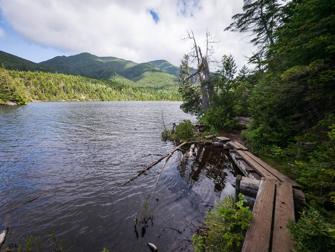
Little boardwalks on muddy sections.
Ascending to Avalanche Pass.
Very cool rock faces within Avalanche Pass.
Avalanche Pass.
Avalanche Pass.
Image 11 from gallery
Approaching Avalanche Lake.
Avalanche Lake.
Avalanche Lake.
The Avalanche Pass Trail wraps around the north side of Avalanche Lake.
Some sturdy construction over the water.
Mount Colden's Trap Dike visible across the lake.
Southwest side of Avalanche Lake, view back.
A junction, keeping left to stay on the Avalanche Pass Trail and wrap around the south side of Lake Colden.
Lake Colden.
Lake Colden.
Wrapping around the lake.
View back along the lovely lakeside hike around Lake Colden. Algonquin Peak visible top center to the north.
Onward east along the Mount Marcy Trail, at a suspension bridge over the Opalescent River.
Mount Marcy Trail parallels the Opalescent River.
Image 24 from gallery
The trail climbs above a narrow, gorgeous portion with swiftwater below.
Junction with the turn-off for Mount Redfield and Cliff Mountain (right).
Heading toward Mount Redfield first, which begins with a beautiful ascent along Uphill Brook.
Lush forest hiking.
Lush forest hiking.
Plenty of excellent spots to enjoy the brook.
Image 30 from gallery
It was a rugged trail covered in large boulders much of the time.
Image 32 from gallery
Ascending through dense vegetation to the summit of Mount Redfield.
Mount Redfield summit view.
After getting back to the junction, onward to Cliff Mountain. It began a bit boggy, but that didn't last long.
Steep ascent up Cliff Mountain.
View back down some of the scrambling.
Class 2+/3 on the way up Cliff Mountain.
A steep hairpin turn to get around a cliff.
Approaching the base of the Class 3 slabs.
View down as I ascend the slabs.
More enjoyable scrambling up the extended slabs section.
The summit area flattens our a bit, going up and over a false summit before reaching the high point.
Cliff Mountain summit.
Last up for today was Mount Marshall. Seen here is the boardwalk crossing the south side of Lake Colden.
An easy to miss junction to start up the Herbert Brook Trail (right).
Along the lush Herbert Brook Trail.
One of many waterfalls on the side of the trail.
Herbert Brook Trail follows a slickrock portion of the watercourse for some time.
Along the slickrock.
View back down the slickrock portion of hiking.
It was an extremely green, mossy, lush trail.
It felt like there were never-ending little cascades.
Image 54 from gallery
Skinny trail at times, but almost always easy to follow.
Image 56 from gallery
View back down as the trail continues to parallel the watercourse.
Now ascending more earnestly toward Mount Marshall.
View back, Algonquin/Iroquois seen center.
Steep, rugged trail to Mount Marshall.
It took me a moment to locate the unmarked Mount Marshall Trail, which would lead me down to the Cold Brook Trail. This descent was more rough, clearly not traveled regularly.
Steep descent down to the saddle with Iroquois Peak.
Iroquois Peak seen above.
I reached the saddle and headed north along the Cold Brook Trail, which was poorly marked and overgrown.
Overgrowth along the northern descent down the Cold Brook Trail.
Along the Cold Brook Trail.
Entering the watercourse, where the trail parallels the drainage for a time.
Beautiful waterfall on the way down.
Junction with the Indian Pass Trail, taking it north.
Paralleling Indian Pass Brook.
A view of Indian Pass Brook. The trail is a little hard to follow for a couple of brief moments.
Passing a shelter along the Indian Pass Trail.
Indian Pass Trail continues through the forest back to the Adirondack Loj. along the way it passes a spur trail to Rocky Falls, but I skipped the excursion.
A view of Heart Lake as I near the trailhead.

Hire me or show me some love!

Hire/refer me as a web developer or send me a few bucks if you find my site useful. I’m not sponsored, so all fees are out-of-pocket and my time preparing trip reports is unpaid. I really appreciate it!