Little Cedar Mountain and Wood Hills in Wood Hills BLM, NV

Hike Little Cedar Mountain and Wood Hills Wood Hills BLM, NV

Class 2 14.2 miles 3200 gain 5-7 hrs Loop
Effort
Beauty
Personality
Solitude

Little Cedar Mountain and Wood Hills GPX Track

I need to offset my substantial website costs somehow! You can download a hike/drive GPX to assist you here. Before sharing my GPX tracks with others, please remember my site is otherwise a free resource.

This route may have access issues.

This route may cross private land, though access is unclear due to the checkerboard pattern of BLM and private parcels, a common land layout in the West created by historic railroad grants.

Jun 11, 2025 — Little Cedar Mountain, also known as Independence Benchmark, is the high point of the Wood Hills, a lumpy, typical Great Basin landscape just south of I‑80. I hadn’t thought much of this range, and from below it’s certainly not very inspiring. However, the spring wildflowers and sweeping views really surprised me. Plus, I added a bit of an adventure into the mix, contributing to making this a nice outing after all.

To reach the trailhead, I headed east from the highway (41.00802, ‑114.96386), passing through a gate next to some mailboxes. I was a bit concerned about trespassing, but there was no negative signage, and my map showed the familiar BLM/private checkerboard parcels found throughout the West. You can legally hike on BLM land in checkerboard areas only if you can access it via a public road, trail, or with landowner permission. Corner crossing (moving between public parcels at a shared corner) is legally disputed and risky, so it’s best to avoid unless clearly permitted, but I decided to go for it. Decent clearance is needed here, as the center hump not worn down by tires was significantly overgrown.

Although the road continues east from where I parked at a junction, I stopped because it became narrower and more harrowing. Now on foot, I followed the road as it climbed gradually through alternating meadows and forest through a wide drainage. As I gained elevation, views toward Hole in the Mountain Peak and the East Humboldt Range became a constant backdrop. I reached a shoulder on the west side of Peak 8262, a minor summit slightly lower than the high point. I continued along the steepening road to just north of this unnamed peak, then went cross‑country up a lovely slope dotted with bright white rocks contrasting against the green grass, quickly reaching the high point. The rolling Wood Hills stretched out around me, and I found myself unexpectedly really enjoying this hike.

I continued south toward Little Cedar Mountain along another old road, but it arced downhill, losing unnecessary elevation, so I opted to contour across the wildflower-filled terrain to the peak’s base instead. Once there, I first just started up the slope without much thought, but I stumbled onto a surprisingly good social/animal trail that led most of the way to the summit. A short Class 2 section was needed to get past some large boulders and through a weakness in a small cliff just below the high point, and a bit more rock‑hopping brought me to the top.

Most hikers would probably just tag Little Cedar Mountain and return by side-hilling off-trail back to the approach road. Truly, if you look at my attached map, my detour out to an unnamed Peak 7986 might seem unnecessary, but I just wasn’t ready to turn back yet. The wildflowers were in bloom, the birds were singing, and I figured I could try for the unnamed peak about two miles away. A quick check of satellite maps (thankfully I had cell reception) revealed a fairly defined trail to its base, and that sealed the deal.

I backtracked from Little Cedar Mountain and reached the trail I had spotted, and it quickly became clear this trail was mostly used by burros these days, though there were occasional cairns and saw-cut marks on trees. I don’t know who built it or when, but it made for a great extension to my hike and I was loving the views along the arced ridge crest.

Near the end of the arced ridge, the trail veered in a different direction. I went cross‑country through easy terrain until I reached a faded double‑track. It was a gentle walk up the slope to the summit along this old road. Along the way, I passed a somewhat hidden residence complete with an outhouse. I would have preferred not to pass so close, but I stayed on the road. I’m not certain this leg of the hike was on public land, as maps show the usual checkerboard of BLM and private parcels. I may have been on someone’s property for a while, but I wasn’t about to knock and ask. The road walk was otherwise uneventful, and the path gradually faded as I neared the summit of Peak 7968.

The descent from Peak 7968 began with some boulder‑hopping before giving way to a steep grassy slope. Brush was easy to avoid, and I soon reached an old double‑track in the canyon below. My plan was to follow this until about 6,600 feet, then head north through the foothills to my car. That plan ended quickly when I ran into a chain‑link fence marked: “Protected habitat, do not enter! Blue Crow Refuge.” Signs were posted on nearly every tree beyond it, so I didn’t want to intrude.

Well, crap. I certainly couldn’t return the way I came, so I pulled up my map with the checkerboard overlay and decided to cut cross‑country instead to avoid the private land. The terrain was a bit annoying with side‑hilling and constant dips in and out of gullies, but I believe I avoided trespassing. It wasn’t a bad detour, but that lingering “I’m not supposed to be here” feeling did take away from the rest of the hike.

Afterward, I reached out to Blue Crow Refuge for clarity on their land boundaries so I could provide more accurate info for anyone considering this route. Their reply, which wasn’t very helpful: “The Wood Hills are checkerboard with private/BLM parcels. Most private parcels are inhabited. My gates facing west are posted with signs. Blue Crow Refuge is parcel number 008550011.”

PEAKS ON HIKE
Elevation (ft) / Prominence (ft)
Peaks on hike
Elevation
Prominence
1
Peak 8262
8262 ft
326 rise
2
Independence Benchmark (Little Cedar Mountain)
8317 ft
2157 rise
3
Peak 7968
7986 ft
443 rise

Hire me or show me some love!

Hire/refer me as a web developer or send me a few bucks if you find my site useful. I'm not sponsored, so all fees are out-of-pocket and my time preparing trip reports is unpaid. I really appreciate it!

Hiking along the old dirt road from where I parked, Little Cedar Mountain seen above.
A random junction along the way, keeping left.
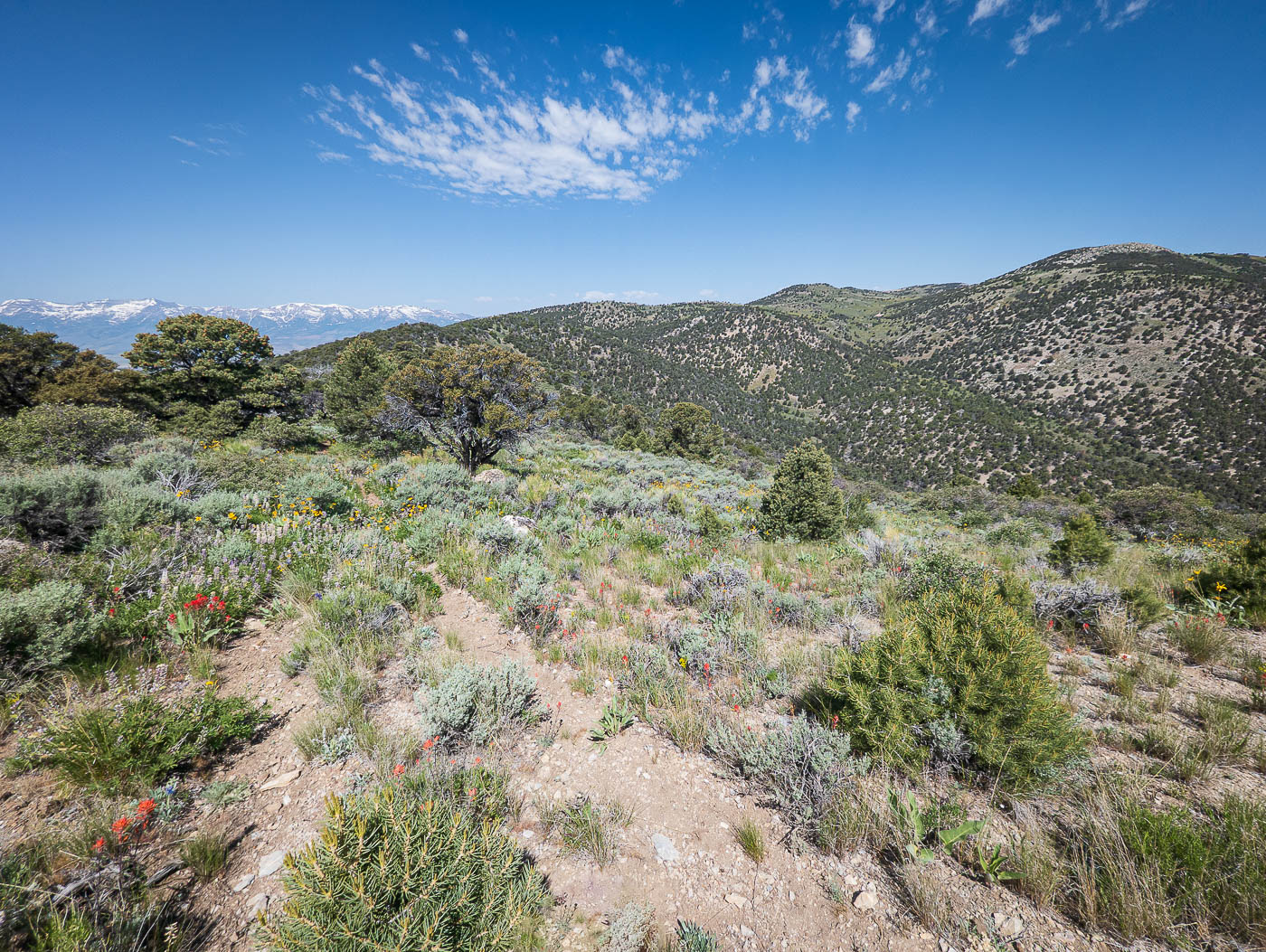
Ascending through trees and meadows.
A relatively tame approach hike so far, not particularly steep.
View back, the East Humboldt Range in the distance.
At a shoulder on the west side of Peak 8262, seen top right.
Peak 8262 above.
Peak 8262 above.
View back before I left the road to head up to Peak 8262.
Easy cross-country up to Peak 8262.
Peak 8262, view north.
Peak 8262, view south, Little Cedar Mountain seen left.
Close-up toward Peak 7968, my third peak later.
Descending an old road from Peak 8262.
Contouring to the base of Little Cedar Mountain, seen ahead.
Nice slope up to Little Cedar Mountain.
Class 2 to gain the ridgeline.
Little Cedar Mountain summit ahead.
Little Cedar Mountain summit, view back toward Peak 8262.
Little Cedar Mountain summit, view north.
I located a well-carved trail, heading south toward Peak 7968 (seen right of center).
View back toward Little Cedar Mountain (right).
Peak 7968 seen across the valley.
Really nice trail.
Really nice trail.
View back toward Little Cedar Mountain (right).
After briefly leaving the trail, I reached this old road and followed it to nearly the summit of Peak 7968.
Passing a residence, oops.
Peak 7968 ahead.
Peak 7968 ahead.
The road ends before the high point.
Peak 7968, view east.
Class 2 descent from Peak 7968, heading down the northwest slope.
View back up at Peak 7968 from along the doubletrack in the drainage below.
Blue Crow Refuge boundary. I left the road and side-hilled to avoid trespassing.
This is what the terrain was like for a couple of miles back to the approach hike road. Not too bad, and I think I managed to avoid private property.
It got even more tame farther along, but the foothills were less pretty than the higher reaches.

Hire me or show me some love!

Hire/refer me as a web developer or send me a few bucks if you find my site useful. I’m not sponsored, so all fees are out-of-pocket and my time preparing trip reports is unpaid. I really appreciate it!