Jay Mountain in Adirondack Park, NY

Hike Jay Mountain Adirondack Park, NY

Class 3 7.8 miles 2800 gain 3-5 hrs Out + Back Jul 3, 2025
Effort
Beauty
Personality
Solitude

Jay Mountain GPX Track

I need to offset my substantial website costs somehow! You can download a hike/drive GPX to assist you here. Before sharing my GPX tracks with others, please remember my site is otherwise a free resource.

Jul 3, 2025 — Jay Mountain offers a gorgeous ridgeline hike with a much easier approach than most peaks in the region, though it seems often overlooked, likely because it sits so close to the more popular Adirondack High Peaks. The trailhead is poorly marked, but there’s a large pull-off on Route 9N near the tiny town of Jay.

I began under a canopy of trees, easing into the day with a gradual ascent through lower-elevation forest. For the first couple of miles the trail kept a gentle pace and offered little in the way of excitement, until it steepened and reached a junction marked “Scenic Overlook.” I took this short spur to get a glimpse of the Jay Mountains ridgeline to come, though it seemed silly considering the views along the ridgeline would soon be far superior.

From there, the trail climbed to the ridgeline, where the trees frequently gave way to open slickrock, revealing sweeping views of an overcast sky and rolling hills in the distance. The second half of the hike unfolded like this, alternating between exposed rock and wooded stretches, with occasional grassy clearings and scattered cairns marking trickier sections. The relatively low effort to get here was quickly rewarded with grand views along Jay Mountain’s spine stretching out behind me.

At the base of the false summit, a short scramble led directly to the top, though a bypass trail skirted around the left. This false summit where most hikers call it a day, but the true high point lies farther east along a less-defined trail and requires more scrambling.

I continued east from the false summit down the slickrock, and reached a short Class 3 downclimb through a weakness in a cliff. Beyond that, a short spurt through the forest led up to a notable cliff with multiple options to overcome it, and then I wove through a small maze of rock outcrops, each offering light scrambling options. Broad slickrock reappeared, and shortly after I reached the true summit of Jay Mountain.

PEAKS ON HIKE
Elevation (ft) / Prominence (ft)
Peaks on hike
Elevation
Prominence
1
Jay Mountain - West Peak
3386 ft
113 rise
2
Jay Mountain
3613 ft
456 rise

Hire me or show me some love!

Hire/refer me as a web developer or send me a few bucks if you find my site useful. I'm not sponsored, so all fees are out-of-pocket and my time preparing trip reports is unpaid. I really appreciate it!

Jay Mountain Trailhead.
Gradual ascent through lower-elevation forest.
Image 2 from gallery
Climbing higher through the forest.
The switchbacks, when present, are tame.
Junction with the Scenic Overlook.
Scenic Overlook, view toward the ridgeline to Jay Mountain.
The trail follows the ridgeline, lots of views along the way.
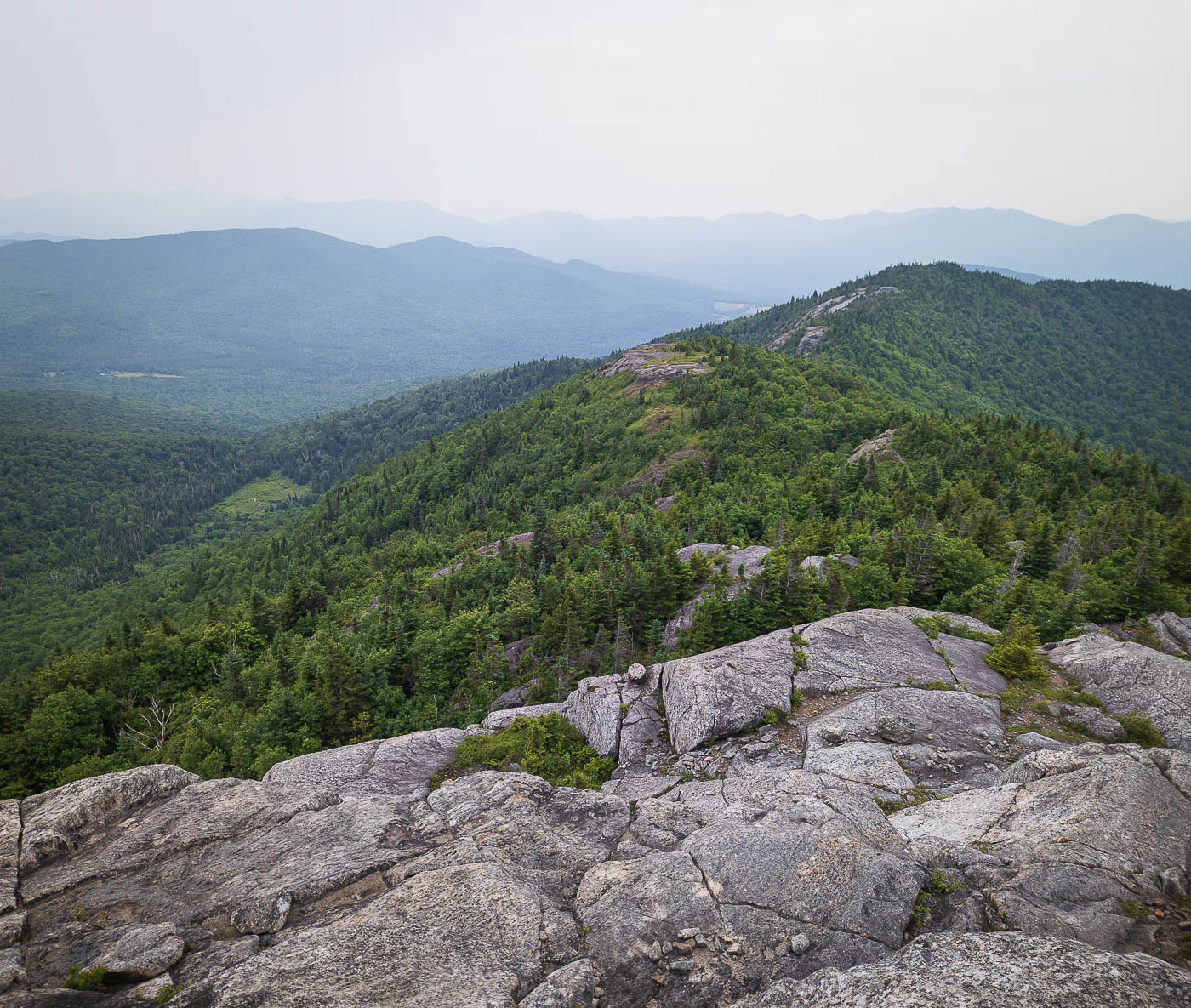
View back along the Jay Mountain ridgeline.
Slickrock along Jay Mountain - West Peak. There's a bit of a dip to the saddle. Jay Mountain is seen center, its false summit on the left.
View back along the slickrock ridgeline.
Farther along the ridgeline.
Brief hike through some lush forest.
View back toward the ridgeline.
The trail alternates between slickrock and trail. Sometimes cairns help mark the way.
A short, optional scramble to the false summit. The trail continues up on the left.
False summit of Jay Mountain, view back along the ridgeline.
Close-up of the ridgeline I hiked along.
Jay Mountain ahead. The trail becomes difficult to follow at times past here.
A Class 3 scramble downclimb.
View back toward the false summit after navigating through the forest and up a weakness in a cliff.
Some more light scrambling on the way to the true summit.
View back at the entire ridgeline so far.
Another brief, pretty spurt through some forest.
After navigating some slickrock, I reached the true high point of Jay Mountain.

Hire me or show me some love!

Hire/refer me as a web developer or send me a few bucks if you find my site useful. I’m not sponsored, so all fees are out-of-pocket and my time preparing trip reports is unpaid. I really appreciate it!