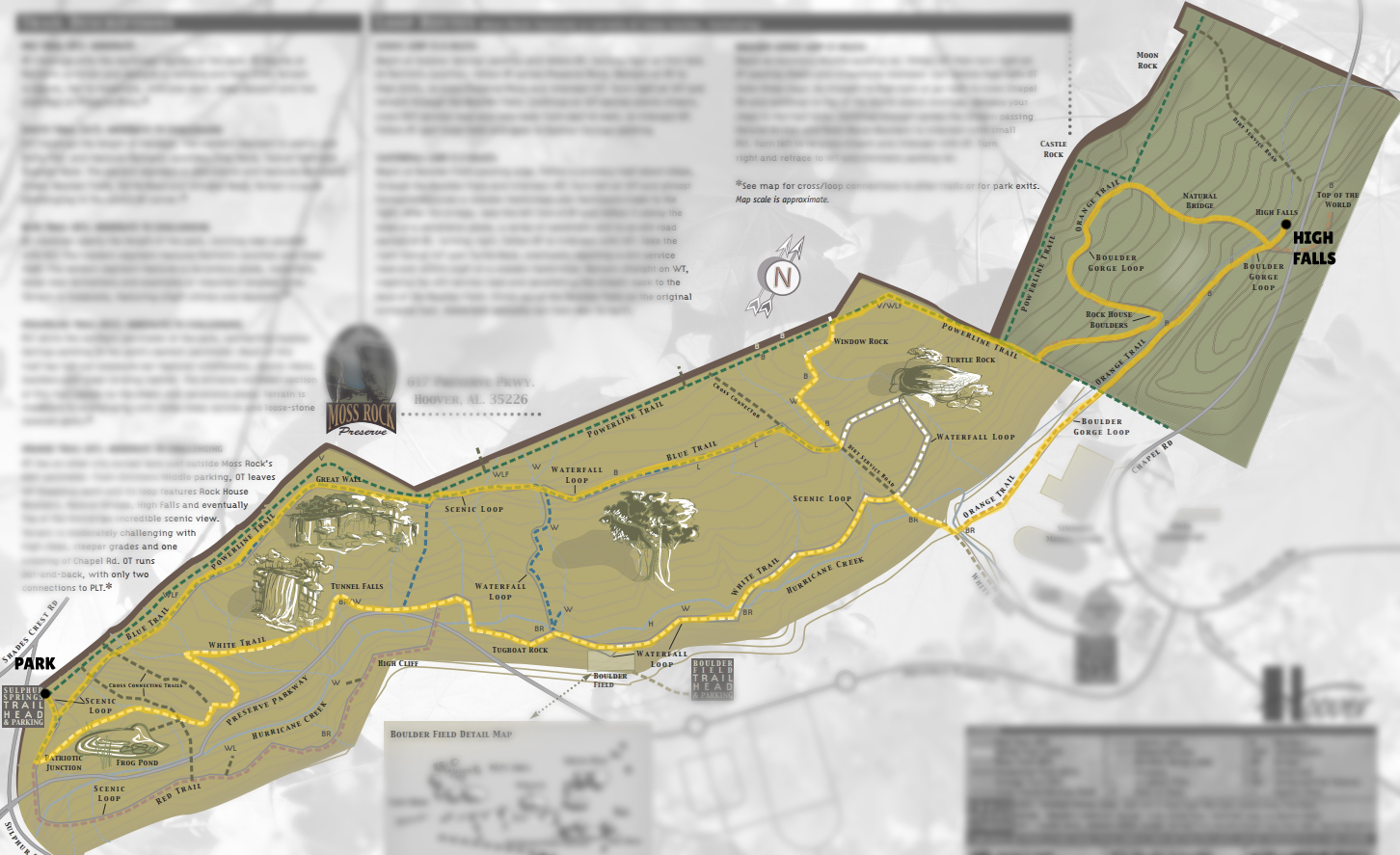
Hike map for High Falls via Hurricane Creek and Waterfall Loop
You can use this map as a resource for hiking High Falls via Hurricane Creek and Waterfall Loop in Moss Rock Preserve, Alabama. Please read my trip report related to this map before blindly using it since my routes are rarely on trails, introducing scrambling and potentially technical elements.
High Falls via Hurricane Creek and Waterfall Loop GPX Track
I need to offset my substantial website costs somehow! You can download a hike/drive GPX to assist you here. Before sharing my GPX tracks with others, please remember my site is otherwise a free resource.