Heartbeat Peak via South Boulder Creek Trail in Arapaho and Roosevelt National Forest, CO

Hike Heartbeat Peak via South Boulder Creek Trail Arapaho and Roosevelt National Forest, CO

Class 1 11.4 miles 3100 gain 4-6 hrs Out + Back
Effort
Beauty
Personality
Solitude

Heartbeat Peak via South Boulder Creek Trail GPX Track

I need to offset my substantial website costs somehow! You can download a hike/drive GPX to assist you here. Before sharing my GPX tracks with others, please remember my site is otherwise a free resource.

Aug 27, 2025 — Heartbeat Peak is a minor 12er along the Continental Divide, just north of Rogers Pass and nearby James Peak plus other 13ers along the divide. I forced a lot of tough hikes on my partner Austin over the years, so today we were just looking for an easier on-trail outing to get some exercise in the mountains. We started at the East Portal Trailhead at the Moffat Tunnel, a railroad and water tunnel built in 1928 still in use today.

We took the South Boulder Creek Trail #900 and entered the James Peak Wilderness. The trail was well-maintained and densely forested. We passed some old buildings toward the start of he hike, and small wooden bridges were constructed over creek crossings. It was a fairly long and gradual ascent all the way up to a junction with the Crater Lakes Trail. Past this the hike steepened, and as we neared Rogers Pass Lake the views opened up to grassy meadows below the Continental Divide.

A bit more ascending got us to the junction with Heart Lake, and the trail continued more steeply up tight switchbacks to Rogers Pass. At the pass, the trail seemed to disappear for a short time, so we strolled cross-country to join the Continental Divide Trail. The CDT took us north through a foggy tundra landscape. Heartbeat Peak is located just off the trail, a quick jaunt on easy terrain, where Heart Lake was visible below.

PEAKS ON HIKE
Elevation (ft) / Prominence (ft)
Peaks on hike
Elevation
Prominence
1
Heartbeat Peak
12224 ft
373 rise

Hire me or show me some love!

Hire/refer me as a web developer or send me a few bucks if you find my site useful. I'm not sponsored, so all fees are out-of-pocket and my time preparing trip reports is unpaid. I really appreciate it!

Moffat Tunnel.
Moffat Tunnel.
South Boulder Creek Trail.
Entering James Peak Wilderness.
Some old building on the side of the South Boulder Creek Trail.
Forested and lush for its majority.
The South Boulder Creek Trail often parallels the creek.
Image 6 from gallery
Little wooden bridges constructed over creek crossings.
We emerged above treeline and made our way up toward Rogers Pass Lake.
Image 9 from gallery
View back as we near Rogers Pass Lake.
Rogers Pass Lake.
Rogers Pass Lake.
Rogers Pass Lake (view later after the clouds had cleared a bit).
View back toward Rogers Pass Lake.
Junction, right leads to Heart Lake, left up to Rogers Pass.
On our way up to Rogers Pass, Heart Lake seen left. The Boulder Creek Trail came up the valley on the right.
Rogers Pass Lake seen below.
Tight switchbacks up to Rogers Pass.
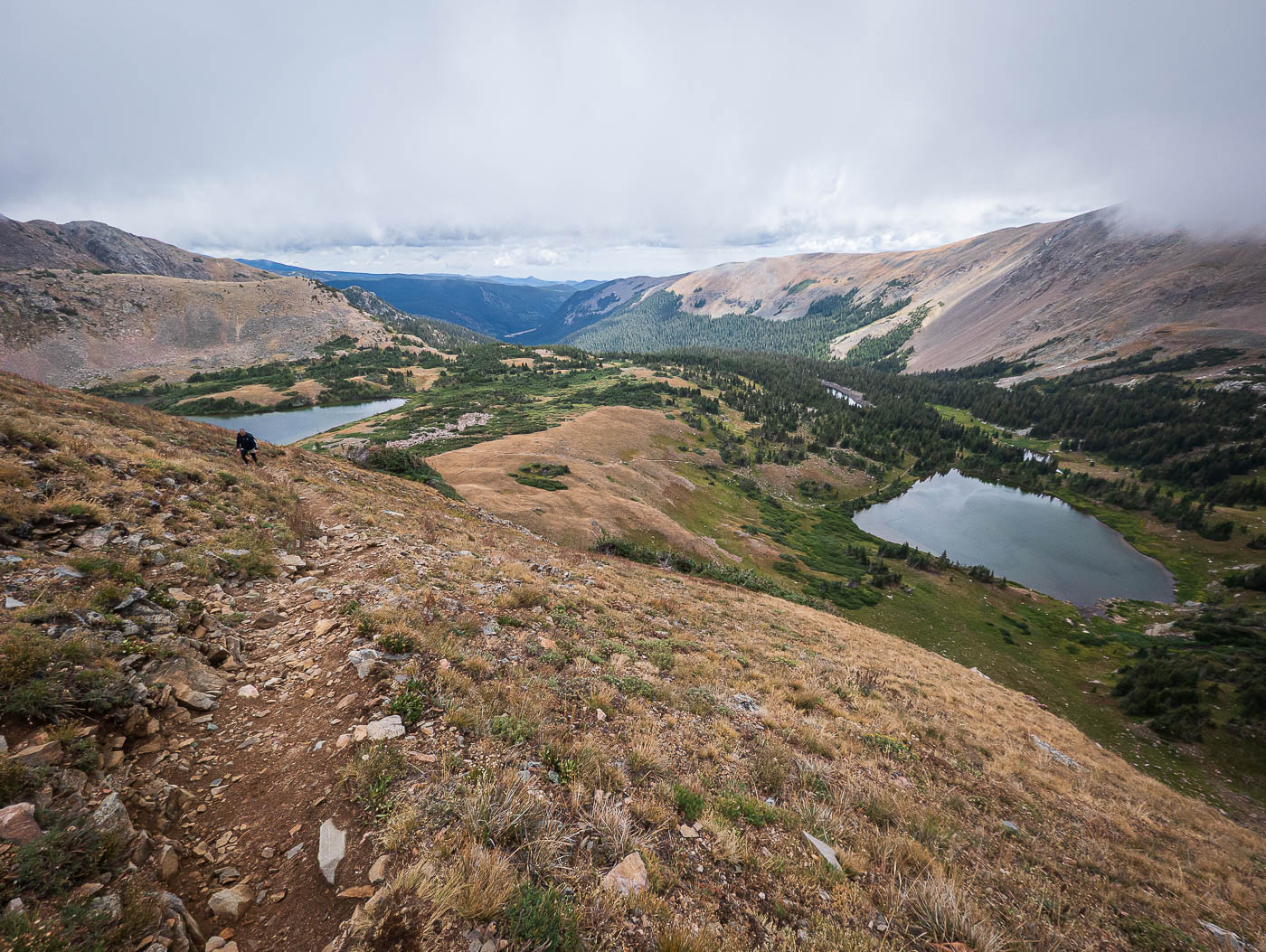
Rogers Pass Lake seen below on the right, Heart Lake left.
Heartbeat Peak seen on the right along the Continental Divide. Rogers Pass just above on the left.
View back toward Rogers Pass as we start along the CDT.
Sweeping tundra along the CDT.
Heartbeat Peak ahead.
Heartbeat Peak summit (a short off-trail jaunt), view back toward the CDT.
Heart Lake below.
Heart Lake below.
Heartbeat Peak, view north.

Hire me or show me some love!

Hire/refer me as a web developer or send me a few bucks if you find my site useful. I’m not sponsored, so all fees are out-of-pocket and my time preparing trip reports is unpaid. I really appreciate it!