Gore Mountain via Shaefer Trail in Adirondack Park, NY

Hike Gore Mountain via Shaefer Trail Adirondack Park, NY

Class 1 9.9 miles 2700 gain 3-5 hrs Out + Back Jul 1, 2025
Effort
Beauty
Personality
Solitude

Gore Mountain via Shaefer Trail GPX Track

I need to offset my substantial website costs somehow! You can download a hike/drive GPX to assist you here. Before sharing my GPX tracks with others, please remember my site is otherwise a free resource.

Jul 1, 2025 — Gore Mountain is better known for its ski slopes, but a hiking trail established by the NYSDEC leads most of the way to its summit. This wasn’t exactly wilderness experience you might enjoy from other Adirondacks hikes, but it’s still pretty. I parked at the the Schaefer Trail trailhead, signed in, and set off along a nice path that initially parallels one of the ski runs. The first mile has a few potentially confusing junctions, but clear signage helps prevent wrong turns. This lower section is a tangle of mountain biking, hiking, and ski trails.

Before long, the Schaefer Trail began following Roaring Brook, and a sign announced the presence of waterfalls ahead. Sure enough, I soon encountered rushing cascades over slickrock, an unexpected and lush treat for the first day of my northeastern trip. The trail climbed gently to moderately along the right side of the water, with only a couple of short scrambles over mossy rock. Overall, the grade was tame relative to other mountains in the Adirondacks.

The Schaefer Trail crosses a few dirt forest roads, and it can be a little tricky to spot where it picks up on the other side. Eventually, I reached the North Creek Reservoir, a small body of water that is basically almost totally avoided by the trail, but I caught my only glimpse of it from the east side before continuing along an old roadbed. From there, the trail wandered through fairly unremarkable forest before reaching a small swampy clearing. Here, the path bent sharply left and began climbing again.

For a couple hundred vertical feet, the grade steepened compared to the rest of the hike, before depositing me on the gravel road that leads to the ski lodge. Summit signs pointed hikers and bikers along the correct route, and while I’m normally not a fan of road walking, these open slopes had clear views of the Adirondack High Peaks.

At the summit, I found a lookout tower and various other human-made structures, but no real view from the top itself. The best scenery came from the road walk just below the summit.

PEAKS ON HIKE
Elevation (ft) / Prominence (ft)
Peaks on hike
Elevation
Prominence
1
Gore Mountain
3590 ft
1895 rise

Hire me or show me some love!

Hire/refer me as a web developer or send me a few bucks if you find my site useful. I'm not sponsored, so all fees are out-of-pocket and my time preparing trip reports is unpaid. I really appreciate it!

Gore Mountain Trailhead.
Initial forest walking with a web of intersecting hiking, ski, and mountain biking trails.
Image 2 from gallery
Paralleling a Roaring Brook below.
Numerous waterfalls over slickrock along Roaring Brook.
Gorgeous waterfalls.
Image 6 from gallery
The Schaefer Trail continues along next to the creek.
It crosses a few dirt roads, picking up on the opposite side.
And more beautiful hiking along Roaring Brook.
Image 10 from gallery
The only notable section of the hike where I needed to navigate a few rocks.
Ascending higher toward North Creek Reservoir.
North Creek Reservoir. The trail wraps around it on the right.
Still parallel to Roaring Brook.
Passing under powerline. It's not the wilderness experience you get from other Adirondacks hikes, but still pretty.
I reached this swampy clearing, and the trail bent abruptly left.
More ski runs to cross over.
Higher elevation meant a shift in the lushness of the forest.
I reached the top of the Schaefer Trail, where a gravel road led the rest of the way to the summit.
View back along a steep section of the gravel road.
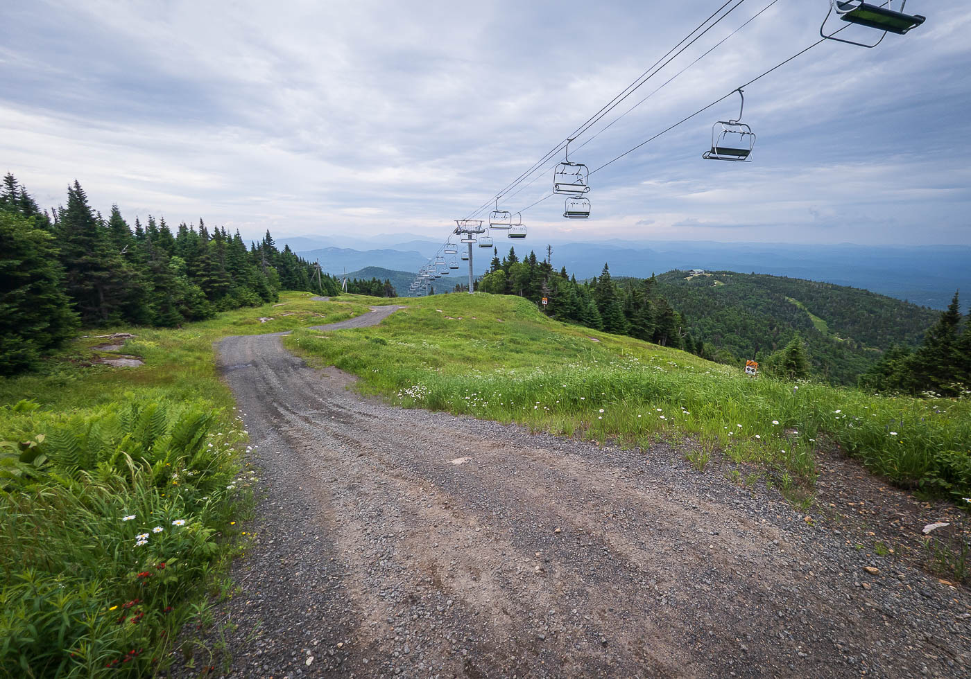
The road leads under a ski lift as I near the summit.
View back, the forest cleared for the ski slopes meant there were views.
High Peaks close-up.
Summit of Gore Mountain, viewless.

Hire me or show me some love!

Hire/refer me as a web developer or send me a few bucks if you find my site useful. I’m not sponsored, so all fees are out-of-pocket and my time preparing trip reports is unpaid. I really appreciate it!