Reynolds Peak, Little Water Peak, Lake Desolation in Uinta-Wasatch-Cache National Forest, UT

Hike Reynolds Peak, Little Water Peak, Lake Desolation Uinta-Wasatch-Cache National Forest, UT

Class 2 10.9 miles 3700 gain 4-6 hrs Loop Jun 15, 2025
Effort
Beauty
Personality
Solitude

Reynolds Peak, Little Water Peak, Lake Desolation GPX Track

I need to offset my substantial website costs somehow! You can download a hike/drive GPX to assist you here. Before sharing my GPX tracks with others, please remember my site is otherwise a free resource.

Reynolds Peak and Little Water Peak are a pair of green summits best accessed from Big Cottonwood Canyon. I should note that I used photos from 2018 for this write‑up since we were simply extending a hike I’d already done, hence the differences in lighting. Luke and I started our day at the Mill D North Fork Trailhead, winding our way up through shady forest and into open meadow stretches. We reached a junction: left led toward Dog Lake (and our two peaks), while right led toward Lake Desolation.

Once we reached Dog Lake, we headed west and located the well-traveled social trail that would lead to Reynolds Peak. It was brutally steep for its majority, but the final stretch to the summit was a lovely ridgeline walk, opening up to sweeping views of the taller Wasatch Mountains.

We retraced our steps back to Dog Lake to begin our push for Little Water Peak. The route north from the lake quickly turned into an annoying bushwhack, and for a moment we considered abandoning the idea in favor of enjoying the extensive trail network instead. But stubbornness won, and we pressed on. Eventually, we broke free from the thick brush onto better terrain.

The slope here was more reasonable, mostly open, with just a short stretch of friendlier forest compared to the initial bushwhack. The final ascent to Little Water Peak’s summit was wide‑open, with expansive views of the Wasatch Mountains, the Great Salt Lake, and the basin of Lake Desolation off to the east. We briefly considered following the ridgeline to the lake, but the possibility of more brush convinced us otherwise.

Instead, we descended Little Water’s southern slope through aspen groves. The brush was minimal, but the slope was steeper than our ascent choice. I imagine most routes up Little Water Peak aren’t great, and it’s a dumb peak except for its summit views. Eventually, we intersected the Desolation Trail and followed it toward the lake, enjoying high‑trail views along the way. We passed the junction with the Dog Lake cutoff before finally rounding a bend to see Lake Desolation ahead.

PEAKS ON HIKE
Elevation (ft) / Prominence (ft)
Peaks on hike
Elevation
Prominence
1
Reynolds Peak
9421 ft
619 rise
2
Little Water Peak
9602 ft
325 rise

Hire me or show me some love!

Hire/refer me as a web developer or send me a few bucks if you find my site useful. I'm not sponsored, so all fees are out-of-pocket and my time preparing trip reports is unpaid. I really appreciate it!

Starting from the Mill D North Fork Trailhead.
Kessler Peak on the right, across Big Cottonwood Canyon.
Image 2 from gallery
Looking back toward Kessler.
Image 4 from gallery
Image 5 from gallery
Continuing along Mill D North Fork Trail.
Junction. Left goes to Dog Lake, right goes to Lake Desolation. First was to the left so we could reach Reynolds Peak and Little Water Peak.
Image 8 from gallery
Approaching Dog Lake.
Dog Lake.
Dog Lake.
Onward to Reynolds Peak.
Steep, but good, trail leading through the forest up to Reynolds Peak.
Hoofing it up the steep slope.
View back down, Little Water Peak seen top center.
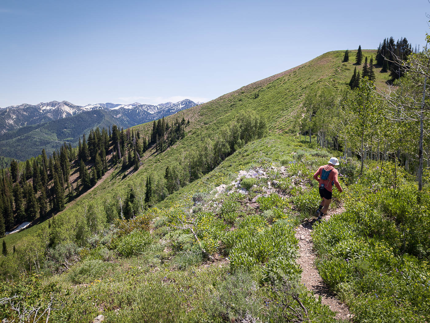
Lovely ridgeline hike to the summit of Reynolds Peak.
Reynolds Peak, view west.
Reynolds Peak, view southwest.
Back at Dog Lake, we headed north to Little Water Peak. It was a bushwhack, and not very fun. We considered not even going for the peak, and just enjoying the extensive trail system instead, btu persisted.
Emerging from the brush onto better terrain.
View southwest back toward Reynolds Peak.
Onward through some forest, though this section wasn't brushy and travel was easy.
Final bit to the summit of Little Water Peak.
Wider shot of the Wasatch Mountains from Little Water Peak's summit.
Great Salt Lake in the distance.
View east in the direction of Lake Desolation. We had considered taking the ridgeline over to the lake, but it seemed possible brushy and decided to skip that route.
We dropped down from Little Water Peak via its southern slope, choosing to hike through aspen groves. The brush was less annoying, but the slope a bit sleeper. We eventually reached the Desolation Trail, taking it to Lake Desolation.
Views along the higher trail from Dog Lake to Lake Desolation.
Image 28 from gallery
Joined with the cutoff trail from Dog Lake to Lake Desolation.
Image 30 from gallery
View back along the Desolation Trail.
Lake Desolation ahead.
Lake Desolation.
Lake Desolation.

Hire me or show me some love!

Hire/refer me as a web developer or send me a few bucks if you find my site useful. I’m not sponsored, so all fees are out-of-pocket and my time preparing trip reports is unpaid. I really appreciate it!