Buffalo Mountain in White River National Forest, CO

Hike Buffalo Mountain White River National Forest, CO

Class 2 5.9 miles 3100 gain 3-5 hrs Out + Back
Effort
Beauty
Personality
Solitude

Buffalo Mountain GPX Track

I need to offset my substantial website costs somehow! You can download a hike/drive GPX to assist you here. Before sharing my GPX tracks with others, please remember my site is otherwise a free resource.

Aug 22, 2025 — Buffalo Mountain is one of the more popular 12ers in Colorado due to its easy access from Silverthorne, short distance, and mostly straightforward trail to its summit. Located on the fringe of the Gore Range, Buffalo Mountain is more of a large lump and doesn’t represent the more jagged peaks for the range. The Buffalo Mountain Trailhead parking lot doesn’t support the high visitation for this trailhead, so I recommend getting there early since the residential roads leading to it do not allow shoulder parking.

The trail starts through a burned area before reaching a junction with the Buffalo Cabin Trail. Taking this leads deeper into the southern Gores, including Red Peak, but I hung left and continued along the Buffalo Mountain Trail and into the Eagles Nest Wilderness. Initially wide and flatter, the trail quickly reaches the base of the peak’s eastern slope and stated ascending more steeply. Wiggling up the slope, the trail had a couple of eroded sections and a couple of wide switchbacks through the trees. I was actually a little surprised at how steep this was for such a popular trail.

I emerged above treeline, marked by a substantial talus field. The trail leads through the boulders, introducing lots of Class 2 obstacles. Cairns helped keep to the intended trail, which is just a route that switchbacks through smaller boulders. It’s pretty easy to miss the correct trail since there are so many cairns and the switchbacks double back frequently. Missing the trail just might mean a more difficult move to overcome large boulders. After a few hundred feet, the trail reached a more prominent bulge forming an eastern ridge, and then wraps around more talus to enter a windswept rocky landscape dotted with little brush and not much else.

I-70 and the various mountain towns around Silverthorne stretched out below around Dillon Reservoir. A final push led up to the summit, some more light boulder-hopping on the way.

PEAKS ON HIKE
Elevation (ft) / Prominence (ft)
Peaks on hike
Elevation
Prominence
1
Buffalo Mountain
12780 ft
908 rise

Hire me or show me some love!

Hire/refer me as a web developer or send me a few bucks if you find my site useful. I'm not sponsored, so all fees are out-of-pocket and my time preparing trip reports is unpaid. I really appreciate it!

Buffalo Mountain Trailhead.
Buffalo Mountain seen on the left as the trail leads though a burn area.
Entering the Eagles Nest Wilderness along the Buffalo Mountain Trail.
Flatter hiking down low through the trees.
View back as the Buffalo Mountain Trail ascends more steeply up the slope.
Eroded in sections.
Eroded in sections.
A few short, tight switchbacks.
Image 7 from gallery
The trail abruptly opens above treeline and into a talus field.
View back down as I start up the Class 2 talus, Dillon Reservoir below.
There's definitely an intended trail, but it's sometime difficult to follow since there are too many cairns and the switchbacks are abrupt.
More progress up the slope.
The trail wraps around the eastern ridge and ascends to a flatter area where the boulders fade away.
Buffalo Mountain top right.
Last bit of ascent to the summit.
View back along the eastern ridge of Buffalo Mountain.
Buffalo Mountain summit ahead.
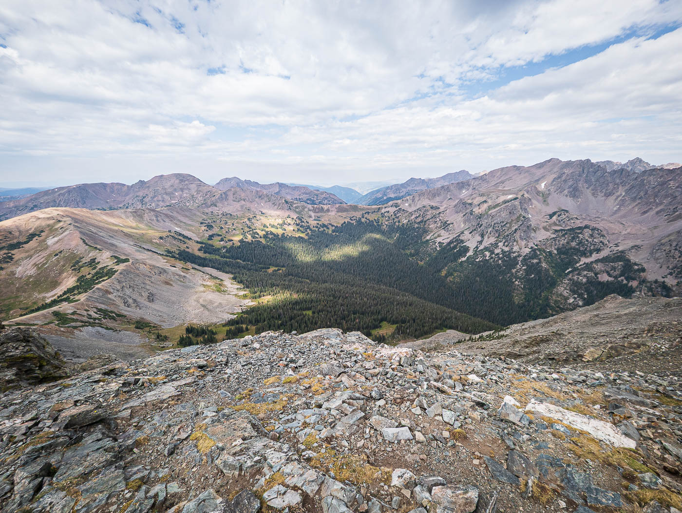
Buffalo Mountain summit, view west.
Close-up toward Red Peak (right).
View down toward Dillon Reservoir, Silverthorne, Frisco, etc.

Hire me or show me some love!

Hire/refer me as a web developer or send me a few bucks if you find my site useful. I’m not sponsored, so all fees are out-of-pocket and my time preparing trip reports is unpaid. I really appreciate it!