Blue Mountain

Adirondack Park, NY Adirondack Mountains

Trip stats

Distance
4.2 mi
Net Gain
1,600 ft
Time
2-4 hrs
YDS Rating
Class 1
Route
Out/Back
Peaks
1

Ratings out of 10

Effort
2.2/10
Personality
3/10
Beauty
4/10
Solitude
2/10
What do these mean? →

Peaks on this hike

Summits listed in route order

  1. Blue Mountain
    3,762′ elevation · 1,954′ prominence

Route map + Trailhead

Trailhead Coordinates

43.874680, -74.431020

The directions link below drops a pin on the trailhead coordinates and lets Google Maps pick the route. If the drive has rough roads or access issues that GPS nav might get wrong, I cover that in my trip report.

Trip report

Jul 6, 2025 — The Blue Mountain Fire Tower Trail hike is a short outing to a fairly high-prominence mountain with great summit views. The trail started gently, more like a wide old road before transitioning to singletrack. It’s typical forested walk. It eventually tilted sharply upward, ascending at a more rapid pace toward the fire tower.

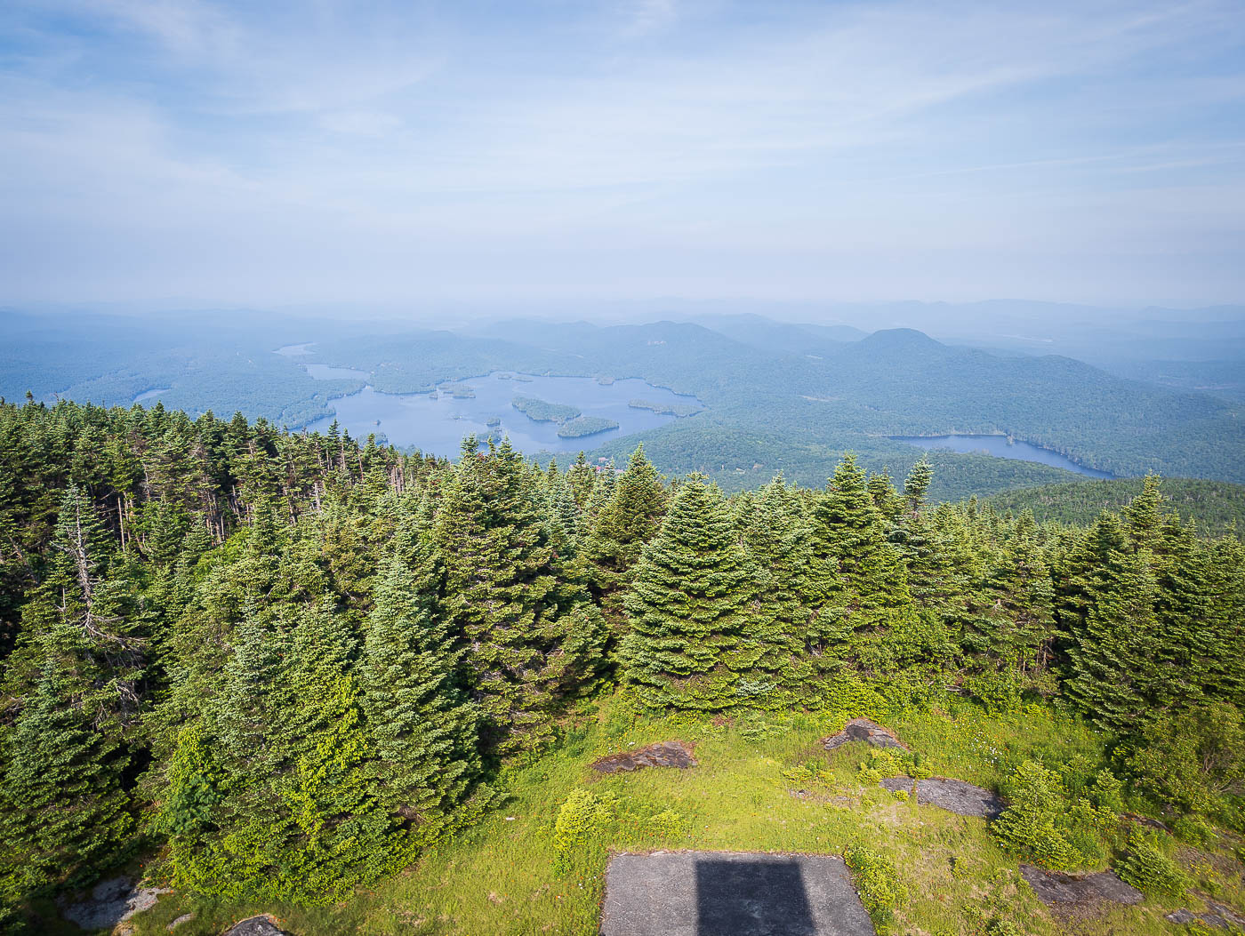
Breaking out at the bald summit, I found the steel fire tower rising above the trees, a 35-foot structure here since 1917. I climbed the narrow stairs to get views of the Adirondacks spread out in every direction. Blue Mountain Lake shimmered below.

Hire me or show some love!

Hire or refer me as a web developer, or send me a few bucks if you find my site useful. I'm not sponsored, so it's funded by yours truly. It also takes a ton of work to edit photos and write these reports. I really appreciate it!

Photos

14 photos

  1. Blue Mountain Trailhead.
  2. The trail is wide and begins climbing gradually.
  3. More like an old roadbed for the first part of the hike than a singletrack.
  4. Typical forest walk along the Blue Mountain Trail.
  5. Planks along the Blue Mountain Trail.
  6. Ascending more steeply now.
  7. Slabs of stone as the trail ascends through progressively more lush forest.
  8. Higher elevation greenery along the Blue Mountain Trail.
  9. Blue Mountain Fire Tower.
  10. View east from within the fire tower.
  11. View east.
  12. View west toward Blue Mountain Lake.

Photo 1 of 1

Hire me or show some love!

Hire or refer me as a web developer, or send me a few bucks if you find my site useful. I'm not sponsored, so it's funded by yours truly. It also takes a ton of work to edit photos and write these reports. I really appreciate it!

GPX track

Blue Mountain GPX route and driving track

The complete GPX track is available to download, so you can load the route straight into your navigation app or device. The trip report, route info, photos and planning details stay free.