

Spitler Peak Trailhead.
Along the initially very tame hike through the scrubby foothills.
Along the Spitler Peak Trail.
Wide switchbacks with mild elevation gain as the Spitler Peak Trail wraps around the west slope of Spitler Peak. Antsell Rock seen center.
View back, Lake Hemet seen below on the left.
Wrapping around the base of Spitler Peak on its scrubby slopes.
The Spitler Peak Peak wrapped into a gully on the northwest side of Spitler Peak and begins switchbacking a bit more steeply.
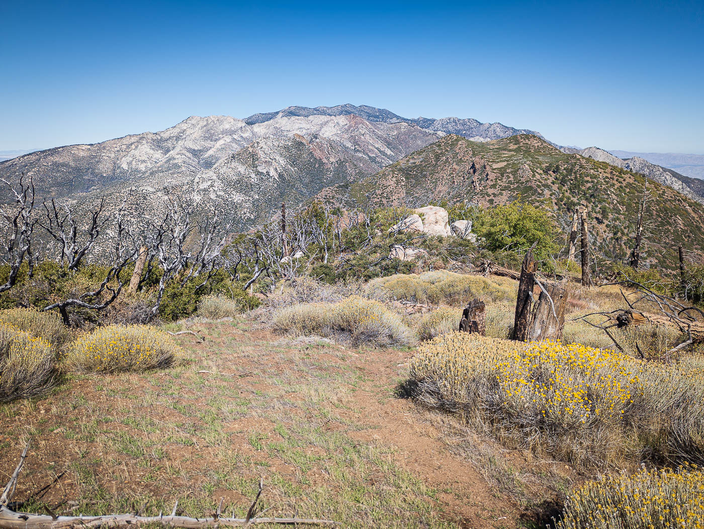
Spitler Peak comes into view as I near the saddle.
The Spitler Peak Peak wrapped into a gully on the northwest side of Spitler Peak and begins switchbacking a bit more steeply.
Nearing the base of Spitler Peak.
Spitler Peak comes into view as I near the saddle.
At the saddle, junction with the Pacific Crest Trail. I took it south.
Nearing the base of Spitler Peak.
View back at the social trail leading away from the PCT up to Spitler Peak.
View back as I ascend the slope to Spitler Peak. Mount San Jacinto, Tahquitz Peak, etc. seen to the north.
Spitler Peak summit, view south.
Spitler Peak, view toward Lake Hemet.
Back at the junction, onward to Apache Peak.
On my way along the PCT to Apache Peak, view back toward Spitler Peak.
Apache Peak is the hump on the left. I had to leave the PCT to reach it, but a social trail leads easily through the brush, though there isn't much.
Some boulders at the summit of Apache Peak.
Apache Peak summit, view north. Antsell Rock seen center, the awful bushwhack within Apple Canyon (my descent) also visible below.
I continued north off Apache Peak. A social trail led down through the brush again, fortunately.
Back along the PCT, a view northeast into the Coachella Valley far below.
View back toward Apache Peak.
Higher up the gully route, heading to the notch ahead, leading to the north side of Antsell Rock.
The PCT wraps above some cliffs to reach the saddle separating Apache Peak from Antsell Rock. Antsell Rock seen left.
View back toward the saddle leading to my descend into Apple Canyon later.
The gully route up to Antsell Rock. Some light Class 2, but it's mostly just a steep sandy slog.
Higher up the gully route, heading to the notch ahead, leading to the north side of Antsell Rock.
View back down the gully route.
Class 3 moves on the right.
Class 3 crack up Antsell Rock.
View back at the Class 3.
Past the Class 3 scramble, I turned a corner and hiked along some slabs. Careful, I saw some Poodle Dog Bush here. The route leads up and to the left in this photo.
Approaching Class 2+ up a wide chute.
View back down at the Class 2+.
Antsell Rock summit, view south toward Apache Peak and Spitler Peak.
Antsell Rock summit, view north toward Tahquitz Peak and Mount San Jacinto.
Antsell Rock, view west.
Back at the saddle, I started down a faint trail through the brush into Apple Canyon.
The descent seems so short, but the brush got worse at around 6600' and continued getting worse until a trail at about 5800'.
If you lose the trail, this is the crap you have to deal with.
Found a dirt road once I reached a riparian area.
View back up at the remains of the trail, just before it disappeared completely.
Hire me or show me some love!
Hire/refer me as a web developer or send me a few bucks if you find my site useful. I’m not sponsored, so all fees are out-of-pocket and my time preparing trip reports is unpaid. I really appreciate it!