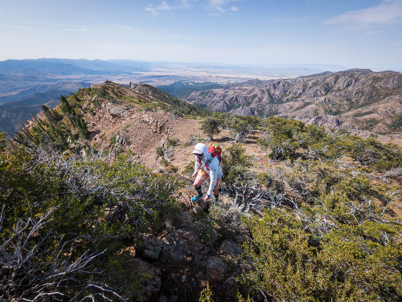
Williams Peak in Fishlake National Forest, UT

Hike Williams Peak Fishlake National Forest, UT

Class 2 5.8 miles 2700 gain 3-5 hrs Loop
Effort
Beauty
Personality
Solitude

Williams Peak GPX Track

I need to offset my substantial website costs somehow! You can download a hike/drive GPX to assist you here. Before sharing my GPX tracks with others, please remember my site is otherwise a free resource.

Sep 5, 2025 — The Canyon Mountains are known best by peakbaggers for Fool Creek Peak, but Williams Peak is a prominent point at the southern end of the range that seemed like a worthwhile little adventure. I’d had my eye on for years, so when Chris and I finally had a half day during our drive through Utah, I jumped on suggesting we snag this peak. I did warn him that he couldn’t be mad at me if it turned out to be a horrible, hot bushwhack, but he agreed anyway. It ended up not being too bad, though by the time we reached the summit, I’d added a fresh set of scratches to my already brush-scarred legs.

I’ve grown to enjoy these lumpy, weird peaks for some reason. Maybe it’s their central Utah charm, sweeping views, or just the range’s easy access from the interstate. The grassy slopes are broken up by strands of small cliffs and clusters of trees, and the brush is never quite bad enough to make hiking miserable.

Whether coming from the north or south on I-15, there’s no exit at Eightmile Road. Instead, exit either direction and take the Frontage Road to here (39.18737, -112.19507) before going under the interstate. Keep right at this junction (39.19328, -112.20025) and continue north into Eightmile Canyon. Any car can make it until the road drops into the canyon, where it becomes rocky and rutted. Our crossover SUVs handled it fine, and we parked at a clearing on the side of the road.

Our plan was to hike Williams Peak as a loop: ascending the brushy south ridge, then returning via Eightmile Canyon along the Eightmile Creek Multi-Use Trail, which would spit us almost right back at our cars. The first few hundred vertical feet were the steepest of the day. While the brush was certainly present, we managed to avoid most of it by zig-zagging around dense patches and small cliff bands.

A bit higher up, more of the ground was covered in rock opposed to dirt and brush, often tempting us to stay along the crest and use the rock to our advantage. However, the crest wasn’t just a direct slope. It dipped repeatedly into notches, forcing us to climb out of one only to drop into the next. Many of the lumps between notches offered Class 2/2+ scrambling fun but added plenty of obstacles and a fair bit of up-and-down travel. Staying left of the crest below the tilted rock provided flatter hiking but less interesting terrain.

The south ridge of Williams Peak felt long, mostly because we often had to slow down to weave through brush. Nearing the summit, an interesting slab of rock offered some enjoyable Class 2 scrambling. A short stretch of ridge walking brought us to the top, where we could see the central peaks of the Canyon Mountains that I’d hiked last fall, as well as Fool Creek Peak, the range high point, in the distance.

We had no desire to return the same way, though we were glad to have checked out the south ridge. It was a worthwhile route and a much more gradual ascent with consistently better views than if we’d come from the west via the Eightmile Creek Trail as an out-and-back. Still, we’d had enough brush for the day, so down the west slope of Williams Peak we went.

The west slope proved to be a much more pleasant route, with far less brush overall. We managed to skirt one notable section of thick vegetation near the base of a small knoll. At the saddle formed by this knoll, we decided to hike over it and descend west into the canyon below, since the slopes on either side looked heavily overgrown. The final descent into Eightmile Creek was uneventful and mostly brush-free.

We were grateful for the Eightmile Creek Trail’s existence. It was easy singletrack through the forest, though in places it had been trampled heavily by cattle. Now, instead of dodging brush, we were dodging cowpies. The trail soon widened into doubletrack, and before long we were back at our cars.

PEAKS ON HIKE
Elevation (ft) / Prominence (ft)
Peaks on hike
Elevation
Prominence
1
Williams Peak
9241 ft
1790 rise

Hire me or show me some love!

Hire/refer me as a web developer or send me a few bucks if you find my site useful. I'm not sponsored, so all fees are out-of-pocket and my time preparing trip reports is unpaid. I really appreciate it!

Leaving the road to start up Williams Peak's south ridge.
A bit brushy along the initial slope, plus a few little cliffs to zig-zag around.
View back into Eightmile Canyon, where we'd started.
Along the south ridge, which looked like this for much of the hike.
Sometimes the brush faded and hiking was easier.
This photo sort of embodies the constant micro-route-finding we were doing. No direct seems ideal due to brush, little cliffs, etc.
Often we'd head to the crest since it felt better than side-hilling on brushier terrain on the left, but the crest was rarely any better/worse.
Along the crest.
Along the crest.
View back toward Eightmile Canyon.
Another example of what the crest often looked like.
Another shot back, Eightmile Canyon on the right.
Higher up, the crest introduced lumps that dropped in and out of notches formed by the slanted rock.
Descending into one of many noted notches.
View back at how these notches appear.
Ascending out of another notch.
View back at the sloped terrain along the south ridge of Williams Peak.
A really cool slab that added some Class 2 fun.
View back down the slab, Eightmile Canyon seen below, which houses the Eightmile Creek Trail we'd take later.
Easier terrain as we near the summit of Williams Peak.
Williams Peak ahead.
View back as we near Williams Peak.
Williams Peak summit, view north toward the heart of the Canyon Mountains.
Williams Peak, view south.
We started west down from Williams Peak. Our goal is the knoll seen center.
Overall a straightforward descent.
View back up the steep slope from Williams Peak.
Ascending the small knoll, view back toward Williams Peak.
Descending from the small knoll into Eightmile Canyon.
We picked up the Eightmile Creek Trail.
The singletrack turned into doubletrack, which we continued along back to our cars.

Hire me or show me some love!

Hire/refer me as a web developer or send me a few bucks if you find my site useful. I’m not sponsored, so all fees are out-of-pocket and my time preparing trip reports is unpaid. I really appreciate it!