Star Peak in Humboldt Range BLM, NV

Hike Star Peak Humboldt Range BLM, NV

Class 2 6.9 miles 2800 gain 3-5 hrs Loop Jun 9, 2025
Effort
Beauty
Personality
Solitude

Star Peak GPX Track

I need to offset my substantial website costs somehow! You can download a hike/drive GPX to assist you here. Before sharing my GPX tracks with others, please remember my site is otherwise a free resource.

Star Peak is the highest point in Nevada’s Humboldt Range and one of the state’s most prominent peaks. You can easily spot it from I‑80 nearby, being one of the Great Basin Desert’s ultra-prominent peaks. The hike mostly follows a road, which depending on your vehicle, can be a quick jaunt or a longer outing. To reach the trailhead, I took this exit (40.59485, -118.25372), then headed east through a mining operation (40.53093, -118.27595). There were “no trespassing” signs on either side, but the road leading to the peak gave me no trouble. On my way back, I even passed some workers who waved, so access seems friendly enough.

The road gradually got steeper, and I parked at a turnout at a hairpin turn. Beyond that, the road was too steep and loose for me to feel comfortable driving my crossover SUV any further. From there, I continued on foot, ascending along Star Peak’s western ridge. The road flattened out for a bit, where I saw a straight-on view of the peak’s treeless slopes dotted with some pretty cool rock outcroppings.

After a few steep switchbacks, I reached the western base of the peak. I decided to keep ascending via the road to make the hike longer and less aggressively steep, compared to heading up directly. The road gradually continued, nearly contouring, to the northern ridge, passing some old mining remains along the way. The summit views were classic Great Basin, surrounding high-prominence ranges all around, with Rye Patch Reservoir down below.

On the way down, I took a more direct line down the slope, cutting off a good chunk of distance. There were faint signs of a social trail, mostly helpful for getting through a rock outcropping (a short section of light Class 2), but otherwise it was just a steep slope back down to the road. Honestly, I found the road ascent way more pleasant, with nice views north along the ridgeline.

PEAKS ON HIKE
Elevation (ft) / Prominence (ft)
Peaks on hike
Elevation
Prominence
1
Star Peak
9837 ft
5400 rise

Hire me or show me some love!

Hire/refer me as a web developer or send me a few bucks if you find my site useful. I'm not sponsored, so all fees are out-of-pocket and my time preparing trip reports is unpaid. I really appreciate it!

Where I parked since the road became too steep for comfort.
Star Peak poking up on the right, but the road ascends for a while before getting a better view.
View back down, Rye Patch Reservoir below.
The road wraps up to Star Peak's western ridge.
Star Peak ahead.
Star Peak ahead.
You can see the road carved horizontally below the summit.
View back.
View back.
A wide switchback up the slope.
I ascended via the road, leading to the northern ridge.
Old mining remains.
Old mining remains.
View back below the summit toward the road walk.
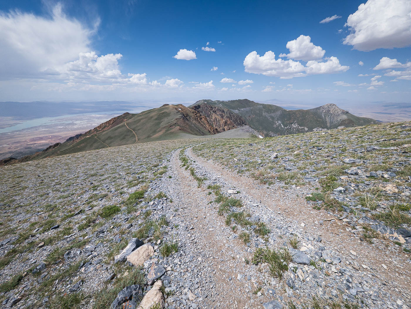
Now along the northern ridge.
View north on my way up.
Wider shot north from a bit before the summit.
Star Peak seen ahead.
Star Peak summit, view north.
Star Peak summit, view south.
Gorgeous green layers of the Humboldt Range.
Close-up south.
Close-up south.
My descent choice more directly down the western slope,, some light Class 2 to pass through a rock outcropping.
View back up at the descent to back to the road walk.

Hire me or show me some love!

Hire/refer me as a web developer or send me a few bucks if you find my site useful. I’m not sponsored, so all fees are out-of-pocket and my time preparing trip reports is unpaid. I really appreciate it!